
THE ULTIMATE 2026 GUIDE TO MOUNTAINEERING IN EAST AFRICA: PEAKS, ROUTES & PLANNING
Mount Kenya Trekking: A 2026 Guide to Chogoria, Sirimon & Naro Moru Routes
Mount Kenya, Africa’s second-highest peak, is often described as the “thinking person’s Kilimanjaro.” Standing at 5,199m, it offers diverse ecosystems, dramatic volcanic plugs, and far fewer crowds than its Tanzanian neighbor.
Whether you’re aiming for the trekking summit of Point Lenana or the technical spires of Batian and Nelion, here is your optimized guide to mountaineering on the Equator.
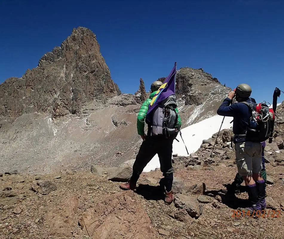
THE THREE PEAKS OF MOUNT KENYA
Unlike many mountains with a single summit, Mount Kenya has a “crown” of three distinct peaks:
- Batian (5,199m): The highest point. This is a technical rock climb (Grade IV) requiring ropes, gear, and advanced experience.
- Nelion (5,188m): The second-highest peak, also requiring technical rock climbing expertise.
- Point Lenana (4,985m): The “trekkers’ summit.” This is reachable by anyone with good fitness and no technical climbing skills are required.
BEST CLIMBING ROUTES FOR 2026
Choosing the right route depends on your fitness level and your desire for scenery versus speed.
Pro Tip: For the ultimate experience, try the Sirimon-Chogoria Traverse. Ascend via Sirimon for better acclimatization and descend via Chogoria for the world-class views.
Sirimon Route (The Gentle Giant)
Best For: Beginners and wildlife enthusiasts.
Duration: 4–5 Days.
Highlights: Located on the dry side of the mountain, it offers a gradual ascent (better for acclimatization) and beautiful yellowwood forests.
Chogoria Route (The Scenic Masterpiece)
Best For: Photographers and nature lovers.
Duration: 5–6 Days.
Highlights: Features dramatic views of the Gorges Valley, Lake Michaelson, and plunging waterfalls. It is widely considered the most beautiful approach.
Naro Moru Route (The Direct Challenge)
Best For: Fit hikers short on time.
Duration: 3–4 Days.
Highlights: The fastest path to the top, but features the infamous “Vertical Bog”—a steep, muddy section that tests your endurance.
Best Time to Climb
While you can climb year-round, timing your trek with the dry seasons ensures better views and safer trails.
- January to March: The warmest months with the clearest skies.
- June to October: Cooler, but very stable weather.
- Technical Seasonality: If you are climbing the technical peaks, the North Face is best from July to September, while the South Face is best from December to March.
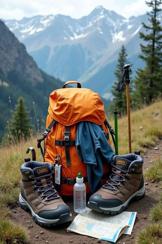
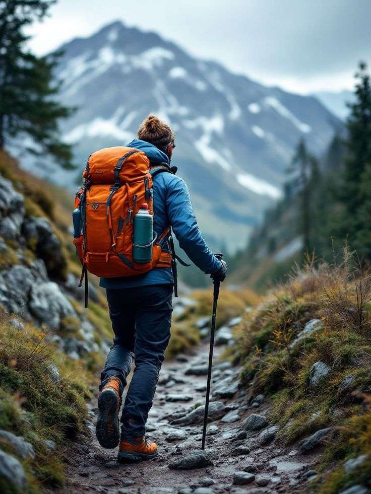
Essential Gear Checklist
Temperatures at the summit can drop to -15°C, even on the Equator.
Footwear: Broken-in waterproof trekking boots and thermal socks.
Clothing: Three-layer system (moisture-wicking base, fleece mid-layer, waterproof/windproof shell).
Sleep: A high-quality sleeping bag rated for at least -10°C.
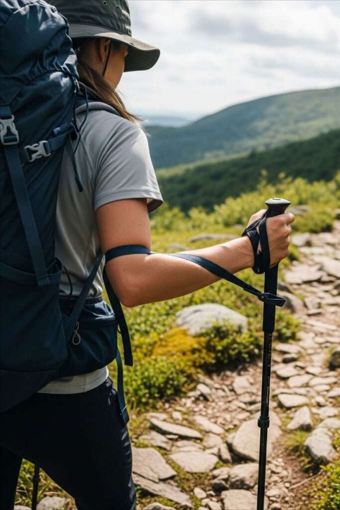
Accessories: Headlamp (for 3:00 AM summit starts), trekking poles, and polarized sunglasses.
Quick Planning Tips
Acclimatization: Spend at least 4–5 days on the mountain to avoid Acute Mountain Sickness (AMS).
Guides are Mandatory: You must be accompanied by a licensed KWS (Kenya Wildlife Service) guide.
Hydration: Aim for 4–5 liters of water daily to help your body process the altitude.
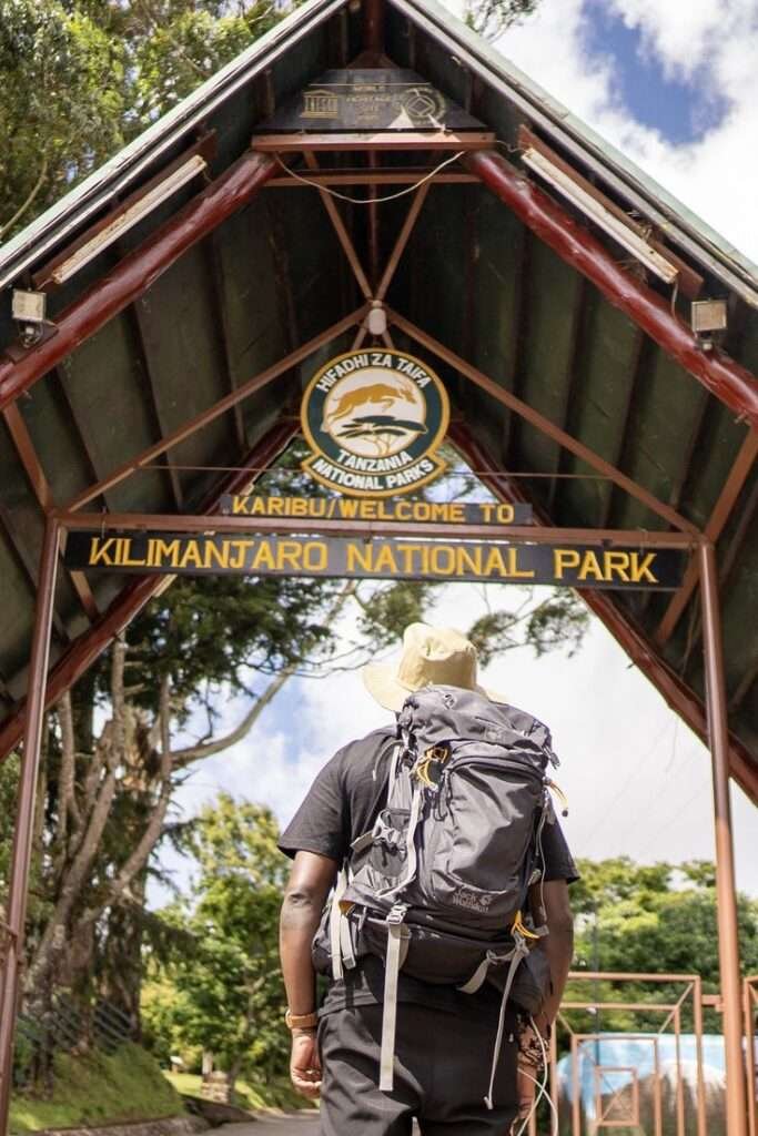
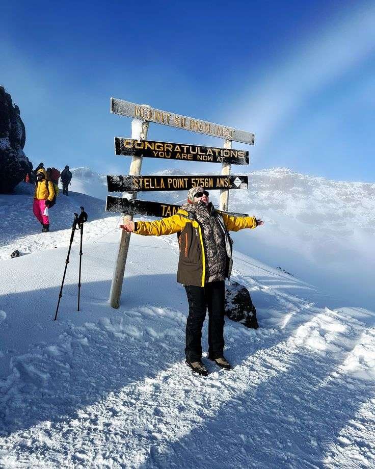
CLIMB MOUNT KILIMANJARO: THE ULTIMATE GUIDE TO THE ROOF OF AFRICA

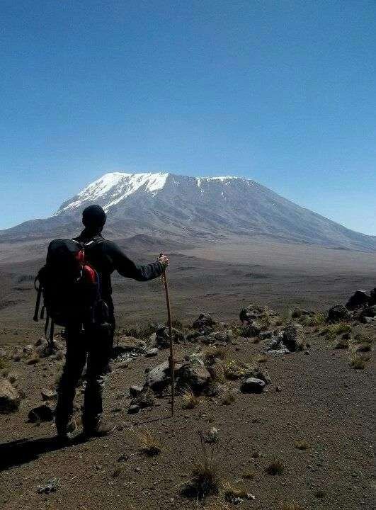
Standing at 5,895 meters (19,341 feet), Mount Kilimanjaro is the crown jewel of East African mountaineering. Whether you are a seasoned hiker or a first-time high-altitude trekker, reaching Uhuru Peak is a life-changing achievement. At Sunup Adventures, we provide expert-led expeditions designed for safety, high success rates, and an unforgettable wilderness experience.
Why Climb Kilimanjaro?
- The Seven Summits: As one of the world’s iconic Seven Summits, it is the most accessible for “everyday” adventurers, requiring no technical climbing skills.
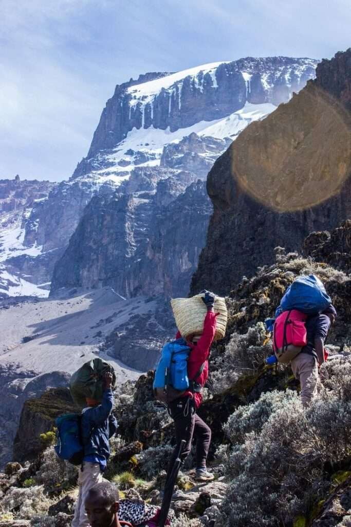
- Biodiversity: Traverse five distinct ecosystems in one week, ranging from lush Montane rainforests to the haunting arctic beauty of the summit glaciers.
- Breathtaking Sunrises: There is no sight quite like watching the sun rise over the African plains from the edge of a massive volcanic crater.
CHOOSING YOUR PATH: THE BEST KILIMANJARO ROUTES
Selecting the right route is the most critical decision for your summit success. Here are the top trails for 2026:
The Lemosho Route (7–8 Days)
Widely considered the most scenic path, Lemosho offers a high success rate due to its excellent acclimatization profile. It approaches from the west and crosses the stunning Shira Plateau.
The Machame Route (6–7 Days)
Known as the “Whiskey Route,” this is the most popular choice for adventurous hikers. It features the famous Barranco Wall climb and offers spectacular views, though it can be physically demanding.
The Northern Circuit (9 Days)
This is the newest and longest route on the mountain. By circling the northern slopes, it offers the highest oxygen adaptation and the most solitude, making it the “Gold Standard” for summit success.
The Marangu Route (5–6 Days)
The “Coca-Cola Route” is the only path that offers sleeping huts instead of camping. While it is the shortest route, the rapid ascent can make acclimatization more challenging.
Best Time to Climb Kilimanjaro
While you can climb year-round, the weather in East Africa typically follows two primary dry seasons:
- January – March: Characterized by clear skies and warmer temperatures; this is often considered the best time for photography.
- June – October: The primary climbing season. While the trails are busier, the weather is incredibly stable and dry.
- The Rainy Seasons: We generally recommend avoiding April, May, and November to ensure the safest and most comfortable trekking conditions.
Preparation and Safety: Your Journey to the Peak
Mountaineering at high altitude requires physical preparation and mental grit. We prioritize your health with rigorous safety protocols:
- Daily Medical Checks: Our guides use pulse oximetry to monitor your oxygen saturation every morning and evening.
- Professional Guidance: All our lead guides are 100% certified Wilderness First Responders (WFR) with years of experience on the mountain.
- The “Pole Pole” Philosophy: We emphasize a slow, steady pace (Swahili for “slowly, slowly”) to help your body adapt naturally to the thinning air.
Frequently Asked Questions
- How much does it cost to climb Kilimanjaro?
In 2026, standard fully-supported climbs range from $2,200 to $3,500. This includes park fees, nutritious meals, professional porters, and high-quality camping gear.
- Do I need technical climbing gear?
No. Kilimanjaro is a “walk-up” mountain. You will need high-quality cold-weather layers, a 4-season sleeping bag, and sturdy, broken-in hiking boots.
- What is the success rate?
Success rates vary by route. Longer routes like the 8-day Lemosho have success rates over 90%, as they allow your body more time to adjust to the altitude.
The Roof of Africa is calling. Our 2026 departure dates are now filling up!
CONQUER THE CRATER: THE ULTIMATE GUIDE TO HIKING MOUNT LONGONOT
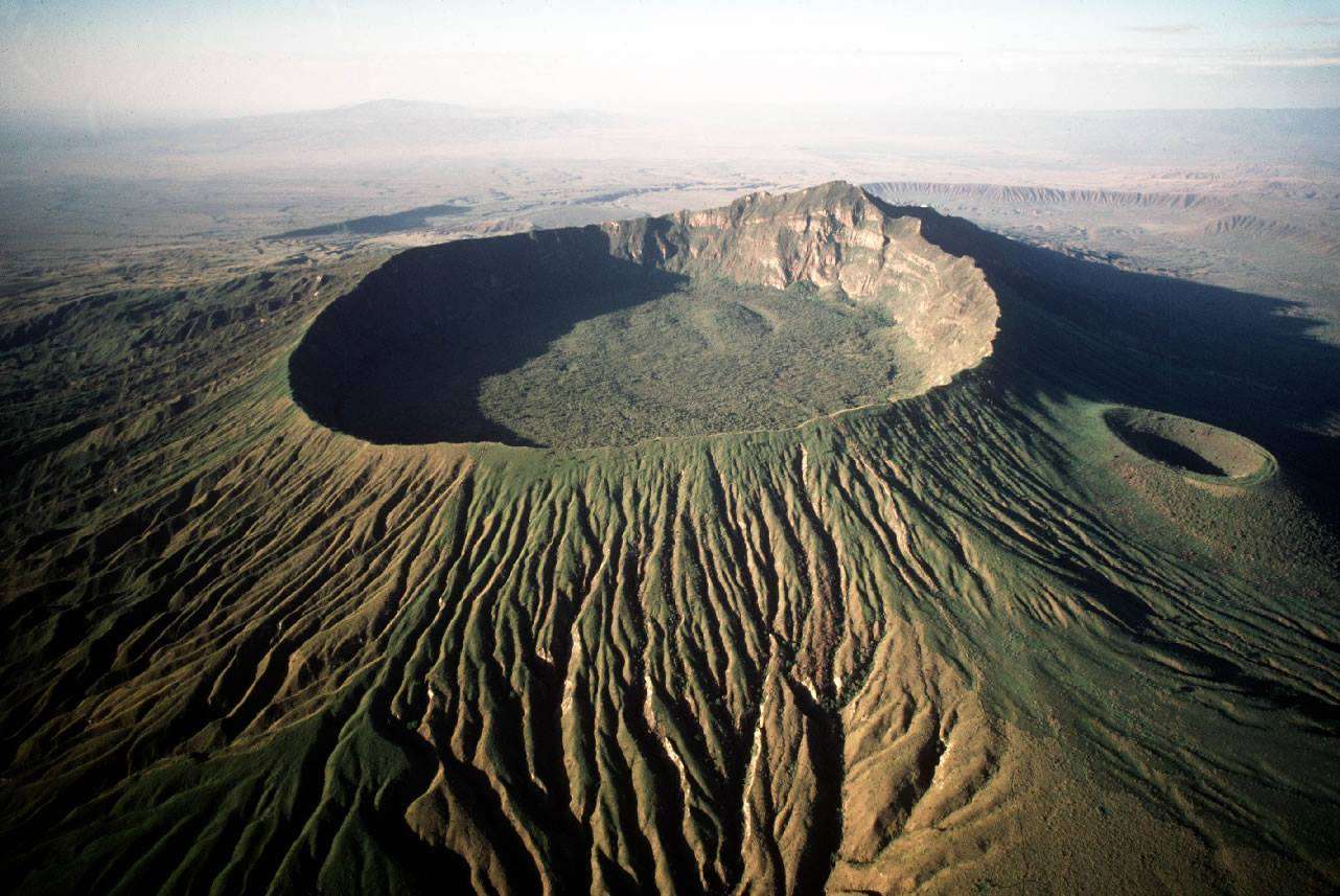
Rising dramatically from the floor of the Great Rift Valley, Mount Longonot is more than just a mountain—it’s a dormant volcano that offers one of the most rewarding day hikes in Kenya. Whether you’re a seasoned trekker or a weekend warrior, the panoramic views of Lake Naivasha and the lush forest floor within the crater are unmatched.
At Sunup Adventures, we’ve led countless hikers to the summit. Here is everything you need to know to conquer this Rift Valley icon.
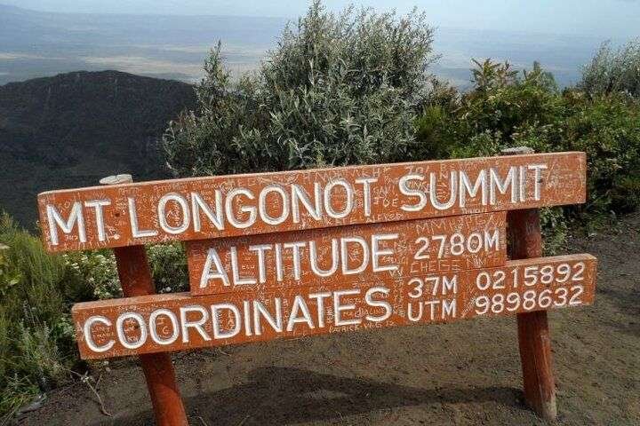
Fast Facts: Mount Longonot National Park
- Elevation: 2,776 meters (9,108 ft) above sea level.
- Distance: 13.5 km (Total loop: Gate to Summit and around the Rim).
- Duration: 4 to 6 hours depending on fitness levels.
- Difficulty: Moderate to High (The “Devil’s Staircase” section is steep!).
- Location: Approximately 90km from Nairobi (1.5 – 2 hours drive).
Best Time to Visit
The best time to climb Mount Longonot is during the dry seasons:
- January to March
- June to October
During the rainy seasons, the volcanic soil becomes slippery and “soapy,” making the steep sections of the Devil’s Staircase quite treacherous.
THE HIKING EXPERIENCE: WHAT TO EXPECT
The trail is divided into three distinct phases. Understanding these will help you pace yourself for the climb.
1. The Ascent to the Rim (3.1 km)
The trail starts at the KWS park gate. The initial climb is dusty and can be quite steep. You’ll navigate rocky terrain and “The Devil’s Staircase”—a series of steep inclines that will definitely get your heart racing.
Pro Tip: Take it slow. The altitude can sneak up on you.
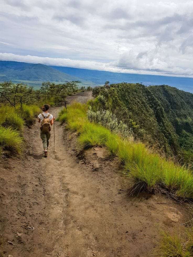
2. The Rim Circuit (7.2 km Loop
Once you reach the crater rim, you have a choice: head back down or tackle the full circle. We highly recommend the loop! It offers 360-degree views of the Rift Valley, the steam vents within the crater, and the sparkling Lake Naivasha in the distance.
3. The Summit (Kilele Ngamia)
The highest point of the rim is Kilele Ngamia. Reaching this peak gives you the ultimate bragging rights and the best vantage point for photos.
Essential Gear Checklist
To ensure a safe and comfortable hike, make sure you pack the following essentials:
Sturdy Hiking Boots: The terrain is loose, volcanic, and often dusty. You need shoes with excellent grip and ankle support to navigate the steep sections.
3 Liters of Water: The Rift Valley sun is intense, and there are no water points on the trail. Staying hydrated is your number one priority.
High-SPF Sun Protection: Use sunscreen, wear a wide-brimmed hat, and bring sunglasses. There is very little shade once you leave the base.
Moisture-Wicking Layers: It can be scorching at the base but surprisingly windy and chilly once you hit the rim. Avoid cotton; opt for light, breathable layers.
Energy-Rich Snacks: Pack trail mix, energy bars, nuts, or fruit to keep your glucose levels steady during the 4-6 hour trek.
Small Backpack: A lightweight daypack to keep your hands free for the steeper “scrambling” sections of the trail.
Why Book with Sunup Adventures?
Navigating the logistics of transport, park fees, and trail safety can be a hassle. When you book your Longonot trek with us, we handle:
Round-trip transport from Nairobi in comfortable vehicles.
Professional guides who know the flora, fauna, and the best “secret” photo spots.
Park entry fees and all administrative clearances.
Healthy packed lunches and hydration.
Note: Mount Longonot is a protected area under the Kenya Wildlife Service. Always follow “Leave No Trace” principles to keep this volcanic wonder pristine for future generations.